Building reliable and scalable geospatial infrastructure in the cloud
A leading provider of geospatial software in the German market needed a robust infrastructure to manage massive volumes of spatial data, ensure 24/7 availability, and efficiently coordinate the work of multiple development and operations teams. Although the platform was based on microservices deployed in Kubernetes clusters, it lacked centralized management and automation, which hindered effective scaling and system maintenance.
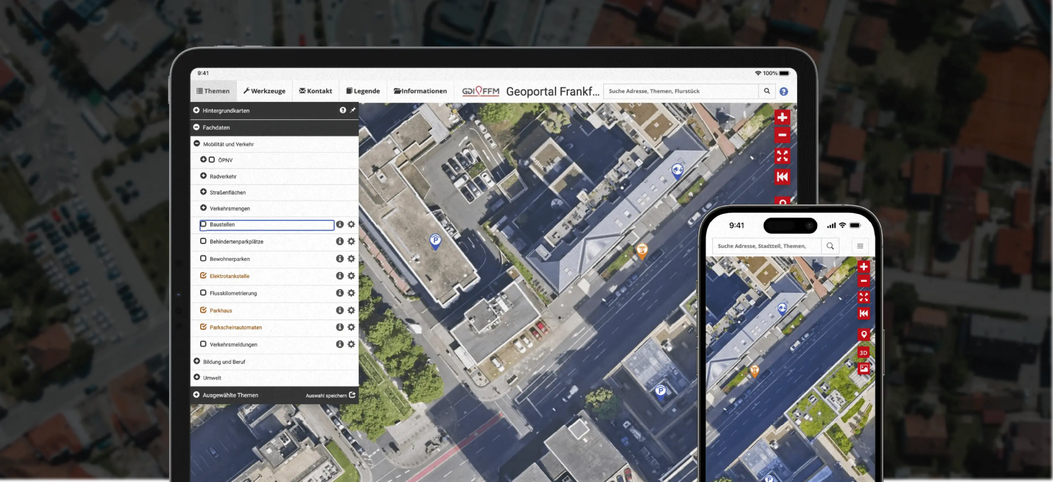
Infrastructure asset management using GIS
The main objectives included:
- Accelerating the creation of new environments for applications and services
- Improving resource utilization across cloud infrastructure
- Streamlining collaboration between development teams and operational environments
- Automating deployment and maintenance processes
- Enhancing overall efficiency and quality of system operations
The challenge was to ensure high availability, stability, and scalability while enabling teams to manage resources efficiently and reduce manual work in a complex multi-service, multi-cluster environment.

Multi-Cloud, GitOps, and DevOps Automation
A dedicated team implemented a comprehensive solution that included:
Infrastructure & Cloud Management
- Multi-cloud deployment in Azure using AKS, Application Gateway, and WAF
- Terraform-based Infrastructure as Code (IaC) for unified workflows and dependency management
- Centralized Kubernetes cluster management with ArgoCD
- Role-based access control (RBAC) for multi-cluster operations
DevOps & Automation
- GitOps principles to synchronize application state with repository configuration
- Automatic deployment of applications and detection/remediation of configuration drift
- CI/CD pipelines with GitLab for seamless delivery and updates
- Microservices orchestration with Kubernetes, Helm, and Docker
Operational Efficiency
- Scalable, modular infrastructure design to support iterative improvements
- Automated monitoring, alerting, and resource management
- Improved collaboration between development, testing, and operations teams
Reliable, Scalable, and Future-Ready Infrastructure
The project delivered measurable business benefits, significantly improving infrastructure and operational performance. Deployment reliability and GIS system resilience increased by over 90%, resulting in more stable environments and minimized downtime risk. The time to provision new environments and scale CI/CD processes was reduced by 70%, accelerating development cycles and the delivery of new features. Operational efficiency and team collaboration improved by 60%, streamlining project coordination and speeding up task execution. With simplified orchestration, monitoring, and infrastructure management, the company can respond faster to changes, better utilize resources, and scale GIS systems more effectively. As a result, the organization gained higher productivity and an enhanced ability to deliver value to clients more quickly.
GIS Cloud Processing Revolution
Why implement multi-cloud architecture for GIS platforms?
A multi-cloud approach provides significant business advantages by increasing fault tolerance, resilience, and scalability. By distributing workloads across multiple cloud providers, organizations minimize downtime and ensure high availability of geospatial services, which is critical for mission-critical applications and real-time data processing. This approach also enables more flexible resource allocation, cost optimization, and risk mitigation across cloud environments.
How GitOps with ArgoCD Improves GIS Cluster Management?
GitOps with ArgoCD enables centralized management of Kubernetes clusters used for GIS data processing from a single location. It automates the deployment of geospatial services and applications while keeping all clusters in sync with declarative configurations. This reduces operational overhead, eliminates configuration drift, and allows teams to quickly detect and resolve deployment issues, ensuring consistent performance of GIS environments and reliable handling of spatial data.
Can the GIS platform scale and support multiple services?
Yes. By combining Azure Kubernetes Service (AKS), a modular microservices architecture, and CI/CD pipelines, the GIS platform enables seamless scaling and handling of increasing workloads, as well as rapid deployment of new geospatial features and services. This allows organizations to dynamically respond to growing demand while maintaining high performance and system reliability.
How has automation impacted the performance and stability of GIS infrastructure?
Automation has significantly improved the performance and stability of GIS infrastructure. By automating deployment, monitoring, and maintenance processes, the number of deployment errors and configuration drifts between environments has decreased. GIS systems have become more predictable and resilient to failures, with reduced mean time to repair (MTTR). Automated processes also ensure consistent performance across multiple clusters and environments, providing stable operation of geospatial applications and services.
What automatic scaling mechanisms are implemented (HPA/VPA, cloud autoscaling)?
The GIS platform uses automatic scaling at both the Kubernetes and cloud levels: Horizontal Pod Autoscaler (HPA) adjusts the number of pod replicas based on workload, Vertical Pod Autoscaler (VPA) optimizes CPU and memory allocation for individual pods, and the AKS Cluster Autoscaler in Azure dynamically adds or removes nodes based on demand, ensuring high availability, stability, and flexible response to increasing workloads.